
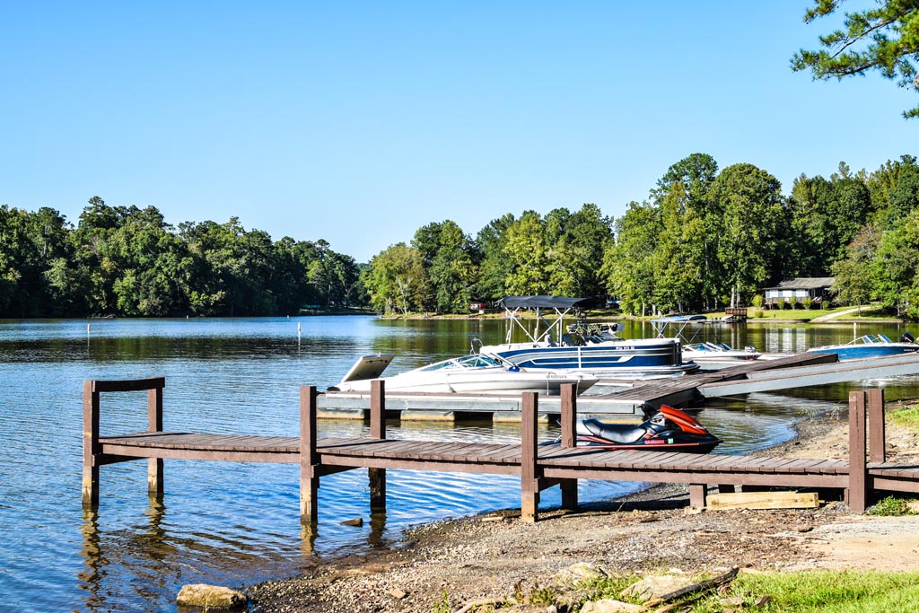
If you’re heading to Bear Creek Marina and wondering about the Jackson Lake water level, here’s the short version: Jackson Lake normally sits between 527 and 530 feet, and Georgia Power keeps it there almost all year. As of August 18, 2026, the lake was reading 528.35 feet on Georgia Power’s own live tracker, about a foot and a half below full pool. That’s a completely ordinary reading, not a warning sign.
Jackson Lake isn’t one of those reservoirs that gets drawn way down every winter and refilled every spring. It’s what Georgia Power calls a “modified run-of-river” project, which just means the lake rises and falls a little each day as water moves through Lloyd Shoals Dam, rather than swinging dramatically with the seasons. Still, a lot of boaters check the number before they hitch up a trailer, especially after a dry stretch, and that’s smart. Below we’ll walk through where that number actually comes from, how to check it yourself in under a minute, and what it means for launching, storing, and fishing on the lake.
Searching for the Bear Creek dam status on Jackson Lake? Here is the plain answer: the dam that forms the lake is Lloyd Shoals Dam, operated by Georgia Power since 1928, and it runs year round to hold Jackson Lake within its normal 527 to 530 foot range. Many people call it the Bear Creek dam because Bear Creek Marina sits on the lake it created, though Jackson Lake itself spans Butts, Henry, Jasper, and Newton counties, not Jackson County. For the live operating status and the exact lake elevation on any given day, Georgia Power posts both on its tracker at lakes.southernco.com, updated each morning.
What Is Jackson Lake’s Normal Water Level?
Jackson Lake’s full pool elevation is 530 feet above sea level. Georgia Power’s own relicensing documents for Lloyd Shoals Dam state that “during normal operations, Lloyd Shoals Dam is operated to maintain lake elevations between approximately 530 and 527 feet year-round, excluding planned drawdowns and drought.” In plain terms, a normal reading anywhere in that three-foot band is exactly where the lake is supposed to be.
The dam itself dates back to 1908-1911, when it was built by the Central Georgia Power Company; Georgia Power acquired it in 1928 and still operates it today, generating power at 18 megawatts during peak demand hours. In 2012, Georgia Power replaced the old spillway flashboards with Obermeyer Gates, inflatable steel gates that let the utility match water releases much more closely to how much water is actually flowing into the lake. That upgrade is a big part of why the Jackson Lake water level tends to stay steadier than it used to.
| Reference Point | Elevation | What It Means |
|---|---|---|
| Full pool | 530 ft | The lake’s normal, “topped off” level |
| Bottom of the normal operating band | 527 ft | Still completely normal; expect it during drier stretches |
| Historic high (1994 flood) | 534.4 ft | An exceptional flood event on the Ocmulgee, not a typical reading |
Jackson Lake covers about 4,750 acres with roughly 135 miles of shoreline when it’s at full pool. It’s formed where the Alcovy, Yellow, and South Rivers come together, and that combined flow forms the Ocmulgee River, which the Lloyd Shoals Dam holds back. The lake itself spans four counties: Butts, Henry, Jasper, and Newton. Bear Creek Marina sits on the northern end of the lake, in Jasper County.
How Do I Check Jackson Lake’s Water Level Right Now?
The fastest way is Georgia Power’s live lake-level page at lakes.southernco.com. It updates every morning and lists every Georgia Power lake by name, including “Jackson (Lloyd Shoals Dam).” The table shows two numbers side by side: the current elevation and the full elevation. Subtract one from the other and you’ve got exactly how far below (or occasionally above) full pool the lake is sitting that day.
Georgia Power also maintains a general water-levels section on its own site under Our Impact, but that page mostly points you back to the live tracker rather than showing the number itself, so the southernco.com tracker is the one to bookmark. There’s also a USGS gauge at the dam, but at the time of writing it isn’t reporting live data, so it’s not a reliable source for a same-day reading.
A quick habit worth building: check the Jackson Lake water level the same way you’d check the weather, the morning of any trip that involves launching a trailer boat or paddling somewhere with a lot of stumps and shallows. It takes about ten seconds and it can save you a scraped hull or an awkward reverse-up-the-ramp moment.
Does Jackson Lake’s Water Level Change With the Seasons?
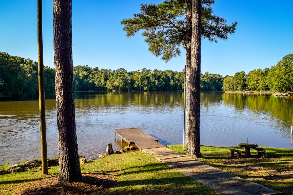
Not the way a lot of Georgia reservoirs do. Army Corps of Engineers flood-control lakes often run a planned winter drawdown and spring refill, sometimes several feet apart. Jackson Lake, being a hydroelectric project run day-to-day by Georgia Power, mostly just rises and falls a little as water is stored overnight and released through the turbines during the day. Georgia Power’s own materials note that the 2012 Obermeyer gate upgrade reduced the need for the kind of planned annual drawdown some reservoirs still schedule. The lake’s temperature is a different story, and our seasonal water temperature guide walks through it.
That said, the Jackson Lake water level does respond to real drought conditions, because the lake can only hold what its watershed sends it. Georgia’s Environmental Protection Division declared a statewide Level 1 Drought Response on April 27, 2026, and because the declaration was statewide it covered Butts, Henry, Jasper, and Newton counties, the four counties Jackson Lake spans. A Level 1 declaration is a regional water-conservation status, not a statement that any specific lake has hit a record low, so it’s worth checking the live tracker rather than assuming the worst from a drought headline alone.
What Happens to Boating When the Water Level Drops?
A few feet of drop doesn’t sound like much until you’re standing at the top of a boat ramp watching the water end well short of where your trailer wheels usually go. The U.S. Army Corps of Engineers, which manages ramps on comparable Georgia reservoirs, generally treats somewhere around three and a half vertical feet below normal as the point where a ramp starts becoming unsafe to use, and posts closures or restrictions well before that. Lower water can also expose stumps, sandbars, and rocks that are normally a safe few feet underwater, so it pays to idle through unfamiliar coves rather than run them at speed after a dry stretch.
Before you tow a boat down to launch, it’s worth reviewing Georgia’s boating laws for Jackson Lake and our full guide to where to launch your boat on Jackson Lake, which covers ramp locations and what to expect at each one. If you’re ever unsure whether a specific ramp is usable at the current level, a quick call to the marina at (770) 787-9621 will get you a real answer faster than guessing from a satellite photo.
One thing that’s completely unaffected by any of this: dry storage. If your boat lives on land in Bear Creek Marina’s covered or uncovered boat storage between trips, the Jackson Lake water level has zero effect on it. That’s one advantage of dry storage over fixed in-water dockage, which can be left high and dry, or occasionally the opposite, when the lake moves outside its normal band.
Quick Facts: Jackson Lake and Lloyd Shoals Dam
- Built: 1908-1911, originally by the Central Georgia Power Company
- Operator: Georgia Power, which acquired the dam in 1928
- Generating capacity: 18 megawatts, run during peak electricity demand
- Surface area at full pool: approximately 4,750 acres
- Shoreline: approximately 135 miles
- Rivers feeding the lake: Alcovy, Yellow, and South Rivers, which join to form the Ocmulgee River that the dam impounds
- Counties: Butts, Henry, Jasper, and Newton
If you want the bigger picture beyond just the Jackson Lake water level, our complete guide to exploring Jackson Lake covers the lake’s history, activities, and access points in more depth, and our Jackson Lake fishing report is a good companion read if conditions on the water are part of what you’re planning around.
Anglers ask about the Jackson Lake water level almost as often as boaters do, since a few inches can change which coves and creek arms hold fish, and where stumps or brush piles that normally sit underwater start to show. If you’re planning a fishing trip around current conditions, it’s worth checking the live tracker the same morning you check the forecast.
Frequently Asked Questions
What is Jackson Lake’s full pool elevation?
530 feet above sea level. Georgia Power operates Lloyd Shoals Dam to keep the lake between roughly 527 and 530 feet during normal conditions.
Where can I check the current Jackson Lake water level?
Georgia Power’s live lake-level tracker at lakes.southernco.com lists Jackson Lake’s current elevation next to its full-pool elevation, updated each morning.
Does the Jackson Lake water level drop a lot in the summer?
Not typically. Jackson Lake is a modified run-of-river reservoir, so it mostly fluctuates a little day to day rather than following a big seasonal drawdown-and-refill pattern. Extended drought can still pull it below the normal band.
Is Jackson Lake currently in a drought?
Georgia’s EPD placed the region that includes Jackson Lake’s counties under a Level 1 Drought Response as of April 27, 2026. Drought status changes over time, so check the live lake-level tracker for the actual current elevation rather than relying on a drought declaration alone.
Will a lower Jackson Lake water level affect boat storage at Bear Creek Marina?
No. Bear Creek Marina’s covered and uncovered dry boat storage keeps boats on land, so changes in the lake’s water level don’t affect stored boats the way they can affect fixed in-water dockage.
How do I know if a boat ramp is usable at the current Jackson Lake water level?
Call Bear Creek Marina at (770) 787-9621 for current conditions, especially after a dry stretch. A few feet of drop matters more at some ramps than others depending on how they’re built.
Who controls the Jackson Lake water level?
Georgia Power controls it through Lloyd Shoals Dam, which the utility has operated since 1928. The dam’s Obermeyer Gates, installed in 2012, give Georgia Power finer control over releases and help keep the lake within its normal 527-530 foot band.
Whatever the Jackson Lake water level is doing today, Bear Creek Marina is here to help you make the most of it, from dry boat storage that never has to worry about the number, to a boat launch and campground on the lake’s northern shore. Stop by at 60 Bear Creek Marina Road, Mansfield, GA 30055, or contact us at (770) 787-9621 with any questions before your next trip.
